The Colombia River to
After the short break at the Maryhill museum of Modern Art
(outside exhibits only) a couple of shots of the Columbia River and the
towering Mt Hood in the distance we headed down the steep and winding road to
the steel lattice bridge and across the Columbia River and once again into
Oregon.
With a few exceptions we would be following the Highway 97
all the way through Oregon to the State Line with California. It is a far
better route than the Interstate Highway 5, the 5 though more direct and
quicker does not pass through the more scenic and idyllic parts of Oregon.
We were aiming for Madras, for no other reason but the name
fascinated me and that Linda when asked what to put into the Satnav said
“Curry”. The weather was hot and fine, we had, had only a little rain up in the
Washington Rainforest (well if you can’t have it in a rainforest, then you
can’t have it anywhere), other than that we had super sunny weather all the
way.
We stopped at a small town (most towns along this route are
small), for lunch, called Moro, we always try to select a small café, deli or
diner to lunch at and were never disappointed, this is where the locals eat so
what does them, does us. We will have sandwich or something light as we will
normal either cook or go out to eat something more substantial when we reach
our campsite. At this one you could even tinkle or whatever one does on an organ. I didn't hear anyone giving a lunchtime recital so may be they shot the last one and word got round.
Linda was the proud owner of a Safeway’s member card, this
gave us money off and points (I don’t know what the points are for) at all
Safeway supermarkets, their subsidiaries and certain a filling station, Linda
gets a bit excited when she gets a dollar off! We will normally pop into a
Safeway’s somewhere along our route and there seems to be a one in most in larger
towns. We also need a constant supply of gas cartridges for our two cookers, we
tend always to have two or three at hand, these are not available in all
hardware stores but we have found them in two main ones (ACE and another) so will always pop in
when we see a one. (Linda was given residency of the State of California by the
kind lady in Safeway’s).
 |
| The Town of Moro |
We had our Sandwich (half each), got petrol (gas) and
moseyed on outa town,I'm picking up the lingo quite quick, Richard in San
Francisco will be proud of me (he teaches English as a foreign language, so I
fit quite nicely into that category).
There was no Safeway’s in Moro and what I
could see no other Supermarket. We didn’t find a one until we reached Shaniko
about 80 miles (we use miles in the States) down the highway in the direction
South.
We passed through mainly agricultural and beef ranches, while to the
East the mighty Cascade’s rolled by, dominated by Mounts Hood and Jefferson.
We eventually reached the town of Madras, (now renamed
Curry), this was a somewhat larger town and as in most larger towns they have a
brown sign directing would be campers in the direction of state campsites, we
tried to use these as often as possible as they are indicated on maps, have a
very good standard and the overnight price is very reasonable.
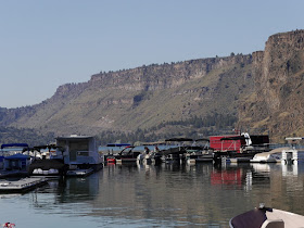
The site was actually not in town but seemed to be a little
way out in what are called the Palisades, we followed the signs and took a turning going East (seemed about
right), this route took us along a precipitous canyon far, far below was a
mighty expanse of water.
The road was in the main surfaced with macadam, but
after what seemed an hour this petered out and a sign said dead end ahead, aha
we said we sure don’t want to go to dead end or even be dead ended, so we
retraced our tracks and got to the starting point, reread the sign and it
certainly said State Park (but not State Park Campsite).
At the top of the road
on a corner of the Frazier and Jorden Peck, we had seen a small store (called
Cove Corner Store) that sold all manner of paraphernalia to do with sailing,
kayaking and water craft.
We decided to ask inside, the owner was most helpful
but was enthralled with Jucy, he had been to New Zealand and seen them there.
He explained that we should carry on back down the road, passing the turn off
we had taken earlier, down an incline and at the bottom we would find two State
Park campsites, he also said that the first we would hit was the best, so we
did as he suggested and found a wonderful campsite for the night (the crooked
River Campsite).
The area is known as Three Rivers, the rivers, Metolius, Deschutes and Crooked
Rivers have been dammed at Round Butte (1964), this formed Lake Billy Chinook.
Billy Chinook was an native tracker who guided the explorer John C. Fremont
through the area in 1843.
Just to celebrate our arrival in Madras, set about making a
chicken curry.
As we ate our evening meal, the sun was setting across the
canyon and mountains, it made a smashing backdrop.
As we were settling down to eat an electric camp site car stopped and The Warden in the car asked if we fancied coming to a talk and slide show about the Hubble Telescope and by the way he had collected a load of unused fire wood that the campers had left behind from the previous weekend. Now that is what I call right neighbourly!
Next morning as normal
I was up at 06:00, I am a creature of habit and 06:00 is the time that nature
calls, so I get up and have a shower and be ready for the coming day. As I
opened Jucy’s door, I saw right in front of me a herd of deer, they were quite
happily munching away at the lush green grass provided free by the State Park.
I had to pass through the herd on the way to the bathroom (toilet) and showers;
they just eyed me and slowly moved away but still kept on munching. I showered
etc and returned to Jucy,
Linda was just getting the kettle on, we like our
morning coffee. She headed off to the showers and on returning I suggested we
go down to the River Marina and have breakfast, they had just opened when we
got there, I caught some small lizards scurrying about in search of their breakfast.
 |
| Out for bit of early morning fishing |
 |
| The Palisades launching and hiring Ramp |
 |
| A Lizard on the outlook for a bit of breakfast |
 |
| Boats for hire |
 |
| The Rock Formation that gives the canyon its name " Palisades" |
We ordered our breakfasts; I
my bacon, egg in a muffin and Linda toast and Jam. We sat in the wonderful
morning sun watching the anglers casting from their boats and boat being hired
out to singles and groups.
All very well but it was soon time to head off onto the Highway 97 and towards our destination for the day, Crater Lake.
We travelled along until we crossed a bridge spanning the
Crooked River, I was interested in the railway bridge a little up River, there
is a small park named after Peter Skene Ogden. Never having heard of him I was
interested to know little more. He was a trapper for the Hudson Bay Fur Company
and done much to open up this area to trade (mostly in furs). The railway
bridge was constructed before the road bridge and was used to transport logging
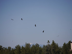
from the vast Oregon Forests, above and below the Turkey Vultures riding the thermal currents, in search of a bite to eat.
 |
| A Turkey Vulture trying to scare some rock doves into making a mistake. |
 |
| The steel trellised railway bridge |
 |
| Below the Crooked River |
 |
| The Old and the New Bridges |
 |
| Mt Hood through the railway bridge arches |
 |
| Turkey Vultures in the thermals |
 |
| Lava Scree |
To the West the white topped mountains of the Cascades rose
on the horizon, with such descriptive names as Three Fingered Jack, The Three
Sisters, Mt Bachelor and the rest of the large mountains formed as the Pacific
tectonic plate pushed itself under the American one.


